Creating wetland within the lower Lugg Valley

Creating wetland within the lower Lugg Valley

Local landowner, Tom Jay, was inspired to look at how he could help reduce the risk of flooding in his local community after the floods of February 2020.

The floodplain of the River Lugg is a unique wetland landscape. It includes a series of lakes formed from gravel extraction pits including Bodenham Lake and Wellington Gravel Pits, and wetland areas like our new wetland at Oak Tree farm.

The river, floodplain and lakes of the Lower Lugg Valley could together provide a fantastic landscape for wetland wildlife. However, currently, the distances between the various lakes, and the lack of permanent pasture along the riverside, restrict the movement of wildlife through this landscape. Though wetland birds, mammals and invertebrates can all be found here, they are not visiting or breeding in anywhere near the numbers they should be, nor do we see the diversity of species which could thrive here.

The lower Lugg valley also experiences other challenges, including regular flooding in winter months, soil and bank erosion and high levels of nutrients. In some cases, natural solutions can be used to help reduce these issues, improving the health of the river and increasing habitat. We have been working with the Environment Agency and a local landowner on one of these natural solutions.

Tom Jay was inspired to look at how he could help his local community after the flooding of February 2020. Living and farming upstream of the village with farmland directly bordering the local watercourse meant that Tom was in the perfect location to consider natural flood management solutions. Tom worked with members of the local community and Head of Nature Recovery at Herefordshire Wildlife Trust, Claire Spicer, to plan and design a series of ponds, known as attenuation ponds. The aim of these ponds is to hold some of the water back on the land to reduce the quantity of water flowing downstream and flooding in problematic areas.

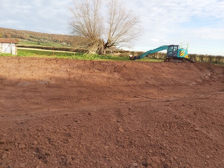
Bare earth with digger in background

The ponds during construction

The ponds have been created across three fields, one of which is permanent pasture and two arable fields. The ponds have inlets and outlets to the stream, so when the stream reaches a certain height the water overflows and fills the ponds. It then feeds back into the stream but at a reduced pace. Some of the water will remain in the ponds after the flood but eventually they will dry out, creating a series of temporary ponds in the landscape. These ponds should help reduce flooding further downstream.

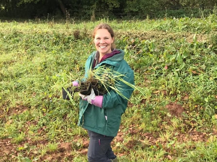
The ponds have been planted up with hardy grasses and some wetland plants, including reeds and rushes. The pond in the pasture field will completely dry out each summer and the grass in its base will be grazed by the sheep who currently use the field. The other two ponds will also largely dry out and grass over in the summer months but will have a variety of plants more suited to damp and boggy conditions. These two ponds are on the edges of arable fields where in the past the shape of the field edge has made it hard for the farmer to easily farm these areas. The arable fields have now been squared off and the area where the ponds are located will be grazed by sheep for short periods to keep the vegetation under control. The ponds create a buffer between the arable land and the stream, helping to reduce the risk of increased nutrients entering the waterway. A further buffer strip of rough grassland lies between the arable field and the ponds themselves.

Woman in green coat smiling at camera holding plants

Sarah King - planting day in Lugg Valley

The ponds will bring a greater variety of wildlife to the site, amphibians will be able to use them as their temporary nature makes them unsuitable for fish which predate young amphibians. More vegetation will provide food and nesting sites for wetland birds, attracting at risk species like curlew to the area.

Working with Tom, the landowner on this site, has been a wonderful experience. To see his commitment to making a difference through the landscape, beyond his farm and then to see the reality taking shape. We hope that we can learn from this project and help other landowners to identify areas of their land which can be used to the benefit of the local community and wildlife, enhancing the work these landowners already do to support wildlife and communities. The project wouldn’t have been successful without the support of Tom.

This project was funded by the Environment Agency.

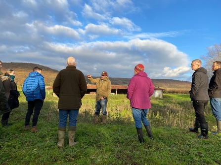
Group of people stood in field

Local farmers and landowners visited the site for a tour from Tom Jay